Japan in Northwest Thailand during World War II
| N18°08
E100°09[1] |
Phrae (Th: แพร่ / Jp: プェエ ) Williams-Hunt (W-H) Aerial Photomosaics Page 1 of 1 |
Route 0101 |
| Text | Notes | |||||||||
|
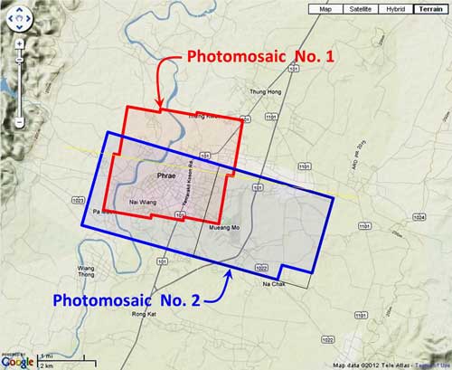
This page discusses World War II aerial photos taken by the Royal Air Force (RAF) and provided on-line by the Geo-spatial Digital Archive Project (GDAP) in its Williams-Hunt Aerial Photograph Digital Collection.[2a] The Williams-Hunt collection has two separate sets of aerial photos for Phrae, located as shown:[3]
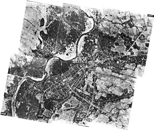
In the following, aerial photos were manually joined into mosaics because Microsoft ICE (Image Composition Editor) introduced too much distortion. Photomosaic No. 1 The area around Phrae outlined above in red was recorded in six RAF aerial photos taken on 07 March 1944:[4]
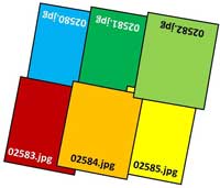
A higher resolution image is available for download here. The following GDAP images were used in the above photomosaic:[5] 02580.jpg and assembled approximately like this, using manual fitting:[6]
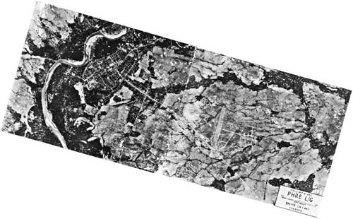
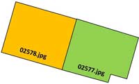
An alternate, macro, two-photo view dated 24 January 1944, as outlined in blue on the site map above, was also recorded:[7]
A higher resolution image is available for download here. The following GDAP images were used in the above photomosaic: and manually assembled approximately like this:[8]
|
See Key for interpreting page content. Revision list. See bottom of Text column on this page. Bibliography supports notes. 1.^ Source: Google Earth fix on apparent center of town. 2.^ Stationing needed. 2a.^ The collection and its origin are described in detail in: Lertlum, PhD, Col Surat, and Dr Elizabeth Moore, Williams-Hunt Aerial Photograph Collection, (undated); available as here linked. Moore, Elizabeth, The Williams-Hunt Collection, Sari - International Journal of the Malay World and Civilisation, 27(2)(2009), pp 265-284. Periasamy, Makeswary, "A View from the Top", biblioasia, 5(1) (Apr 2009), pp 38-42. 3.^ "Terrain" map from Nations Online Project: Searchable Map and Satellite View of Thailand using Google Earth Data. Annotation (red & blue colored items) aligned with Adobe PhotoShop and placed with Microsoft Publisher by author. 4.^ Photos were manually assembled. The mosaic is oriented so that its north is to the top of the page.
5.^ The files used here are 1024 KB. Downloading the files which are designated "[full size]" requires a special request form to be emailed to the Head, GDAP.
6.^ Drawn with Microsoft Publisher by author.
7.^ Photos were manually assembled. The mosaic is reoriented so that its north is to the top of the page.
8.^ Drawn with Microsoft Publisher by author.
|
|||||||||