Japan in Northwest Thailand during World War II
| N18°17 E99°28[1] |
Lampang (Th: ลำปาง / Jp: ランパーン ) Williams-Hunt (W-H) Aerial Photomosaic Page 1 of 1 |
Major transport hub[2] |
| Text | Notes | ||||||||||||
|
This page discusses World War II aerial photos taken by the Royal Air Force (RAF) and a US Army Air Force (USAAF) Photographic Reconnaissance Squadron (PR or PRS), and provided on-line by the Geo-spatial Digital Archive Project (GDAP) in its Williams-Hunt Aerial Photograph Digital Collection.[2a]
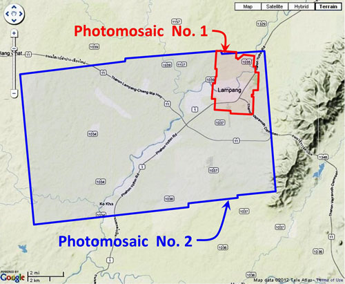
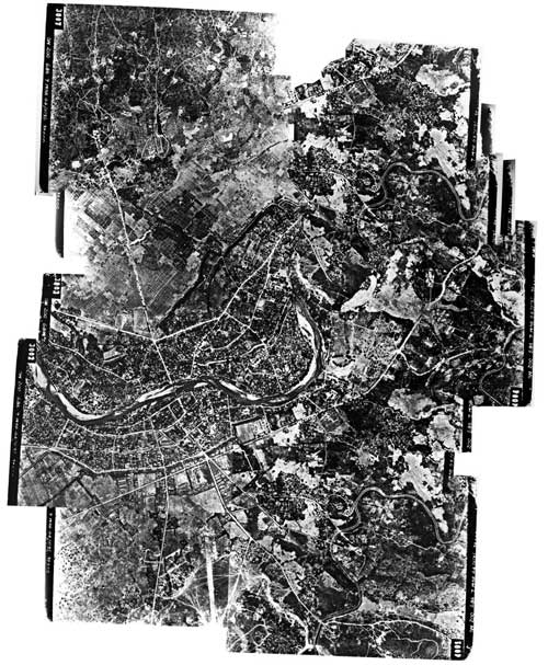
A mosaic, outlined in red on the site map above, was assembled by Allied intelligence and published on 15 November 1943:[4]
A higher resolution image is available for download here. The following GDAP images were used in the above photomosaic:[5]
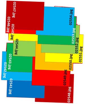
02541.jpg and assembled approximatey like this, using Microsoft ICE:[6]
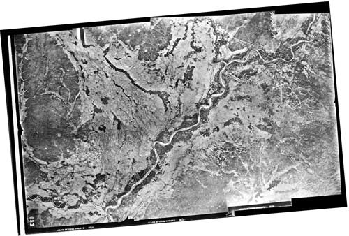
The area around Lampang outlined above in blue was recorded on three USAAF aerial photos taken late in 1945:[7]
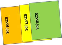
Lampang is located in the upper right quadrant of the mosaic. The airfield with crosswinds runway looks like a small dagger pointed downward. A higher resolution image is available for download here. While undated the photos have recently been determined to have been taken late in 1945 (see discussion in footnote 6a below). The following GDAP images were used in the above photomosaic:[8] and assembled approximately like this, using ICE:[9]
Note that almost all photos in the Williams-Hunt Collection were taken by the RAF. These three however are among a very few in the collection which were taken by the USAAF, specifically the 40th Photographic Reconnaissance Squadron; hence, the "40PR". Annotations on the negatives read:[10]
GDAP, the source of these photos, has asked that the following information be included regarding the aerial imagery shown above:
|
See Key for interpreting page content. Revision list. See bottom of Text column on this page. Bibliography supports notes. 1.^ Source: Google Earth. 2.^ Stationing needed. 2a.^ The collection and its origin are described in detail in: Lertlum, PhD, Col Surat, and Dr Elizabeth Moore, Williams-Hunt Aerial Photograph Collection, (undated); available as here linked. Moore, Elizabeth, The Williams-Hunt Collection, Sari - International Journal of the Malay World and Civilisation, 27(2)(2009), pp 265-284. Periasamy, Makeswary, 3.^ "Terrain" map from Nations Online Project: Searchable Map and Satellite View of Thailand using Google Earth Data. Annotation (red & blue colored items) placed with PhotoShop by author. 4.^ Photos were assembled using Microsoft ICE (Image Composition Editor). Mosaic has been oriented so that its north is to the top of the page.
5.^ The files used here are 1024 KB. Downloading the files which are designated
6.^ Drawn by author with Microsoft Publisher.
7.^ Photos were assembled using Microsoft ICE (Image Composition Editor). Mosaic has been oriented so that its north is to the top of the page. Photos were taken by the 40th Photographic Reconnaissance Squadron, Combat Squadrons of the Air Force World War II, p 188. See note 10 below on how this mosaic was dated.
8.^ The files used here are 1024 KB. Downloading the files which are designated 9.^ Drawn by author with Microsoft Publisher.
10.^ Extracted from the images numbered 02556.jpg, 02557.jpg, 02558.jpg as linked above. The 40th PRS is noted only briefly in Wikipedia's The characters, 5M135, in the annotations are assumed to indicate that the photos were taken in late 1945. The 5 is the year, 1945; the M seems to be a standard designator in aerial photo work; the 135 is the sequence of the order in the 1945 series, which, with that large number, is assumed to be very late in that year.
|
||||||||||||