Lanna-ww2[1]
Japan in Northwest Thailand during World War II
ANNOTATED TABLE OF CONTENTS Notes for this page are located at the bottom. |
|||||
| Introduction with graphical map index (clicking location names on the map will lead to subordinate tables of contents). |
|||||
| Content | |||||
| Northwestern Thailand general[2] history | |||||
| Chiang Mai town was attractive to the Imperial Japanese Army (IJA) for several reasons, including: Air access into Central Burma to support an IJA land invasion north from Rangoon via an established airport, the largest in northern Thailand An all-weather supply link via the Thai railway system An existing Thai military garrison |
|||||
| Air facilities: | |||||
| Chiang Mai Airport | |||||
| Thai air mail service network reached northern Thailand in 1940 | |||||
| Events just before the war: surveillance flights | |||||
| 24 March 1942: Flying Tiger air raid Bond: Leader of the attack Neale: Squadron leader Newkirk: killed in crash McGarry: bailed out & captured |
|||||
| Various aerial photos of Chiang Mai, including RAF mosaic in April 1944 | |||||
| Wat Rampoeng Road: IJAAF aircraft were hidden under trees along the road connecting the wat and the airfield |
|||||
| Satellite airport: San Kamphaeng | |||||
| Rail facilities | |||||
| Railway | |||||
| History relevant to Chiang Mai before WWII | |||||
|
21 December 1943: Allied air raid on Chiang Mai railway station, 300+ killed View from the air View from the ground General Chiang Mai railway station destroyed Sangthai rice mill damaged | |||||
| Transport between railroad station and airport | |||||
| Military facilities | |||||
| Pre-war: Kawila Barracks | |||||
| Thai Army actions on start of war | |||||
| IJA arrival and expansion in Chiang Mai | |||||
| Headquarters: Wattanathaipayap School | |||||
| Probable senior officer quarters | |||||
| Queripol residence | |||||
| Donavanik residence | |||||
| Troop concentrations | |||||
| Nong Ho Camp | |||||
| Wat Muen San | |||||
| Wat Sri Supan | |||||
| Wat Umong | |||||
| Health services | |||||
| American Hospital: status during war, as yet unclear | |||||
| McCormick Hospital: occupied by Thai troops at beginning of war | |||||
| McKean Hospital: relatively uninvolved with the IJA who generally feared leprosy | |||||
| Chiang Mai (IJA): as yet, not located | |||||
| Don Kaeo (IJA): near Nakornping Hospital (Route 107), it is unmarked today | |||||
| Huai Kaeo (IJA): as yet, not located | |||||
| Defense systems | |||||
| Anti-aircraft batteries: Sources include Thai narratives & USAF aerial photos | |||||
| Church: machine gun in steeple | |||||
| Air raid early warning system manned by Thai military | |||||
| Bunkers built throughout the city | |||||
| Other Japanese facilities | |||||
| Japanese consulate | |||||
| Tanaka's shop / residence | |||||
| Other points of interest | |||||
| Only power source for city: Diesel engine - electric generator located near Gymkhana Club | |||||
| Saw mill (east of Wat Phra Singh): Owned by Donavanik Family | |||||
| Saw mill (west of RR sta) | |||||
| Samranchon shop: Bicycle repair shop personnel assisted Allied POWs at Wat Muen San | |||||
| Gymkhana Club | |||||
| Schools closed: Prince Royal's College: closed during the war; at war's end, it became British Army HQ Yupparaj Wittayalai School: closed during the war; it was an anti-aircraft battery site Montfort College: closed during the war Wattanathaipayap School: closed during the war --- it became IJA HQ Dara Academy: closed during the war |
|||||
| Coffee shop: at east end of Nawarat Bridge, Witchit Jarawan, Proprietor | |||||
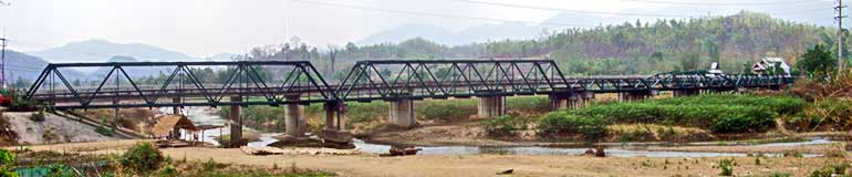
| Ping River Bridges: research on the older bridges in Chiang Mai was necessary in order to try to determine the source of the six spans of the "Bridge on the River Pai": Nakhon Ping Bridge Foot Bridge Nawarat Bridge Iron Bridge |
|||||
| Chiang Mai province, of which the town was the administrative center, had these additional points of interest with regard to WWII: |
|||||
| 0107[3] | 024[3a] | Mae Taeng | |||
| 0107 | 081[4a] | Connection to Route 1178 | |||
| 0107 | --- | 1178: 040+[4a] Arunothai | |||
| 0107 | --- | 050+[4a] Doi Pha Wok/Boundary Pillar No 16 Crossing Point | |||
| 0107 | 145[4a] | Fang oil field | |||
| 1099 | 040[4a] | Om Koi IJAAF aircraft wreckage | |||
| 1322 | 056[4a] | Wiang Haeng Allied aircraft wreckage | |||
| Mae Hong Son province: west of Chiang Mai province, with Central Burma to the west of Mae Hong Son, it became especially relevant during WWII because of several towns: |
|||||
| Mae Hong Son town, the provincial seat | |||||
| Mae Hong Son Airstrip | |||||
| Land transportation hub | |||||
| Khun Yuam, the eventual IJA gateway from Burma | |||||
| Khun Yuam Airstrip | |||||
| Land transportation hub | |||||
| Mae Sariang, gateway to Papun, Burma | |||||
| Mae Sariang Airstrip | |||||
| Land transportation hub | |||||
| Mae Sam Laep / Tha Ta Fang, border point | |||||
| Pai, the main settlement between Mae Hong Son and Chiang Mai towns | |||||
| Muang Noi, Reported site of mass burial of IJA troops | |||||
| Route choice by IJA within Thailand to Burma for invasion of India planned for 1944 Three alternate routes were considered, and each of them played a significant role in WWII. 1. Tak - Mae Sot (border point) 2. Lampang - Chiang Rai - Mai Sai (border point) 3. Chiang Mai - Mae Hong Son - Khun Yuam - Border Point 13 Each is reviewed below: |
|||||
| 1. | Tak - Mae Sot (an existing trail into Burma and Rangoon) | ||||
| ---- | --- | General: 1942: most northerly IJA invasion point into Burma | |||
| (000) | 0105 | 000 | Tak: motor vehicle road to west ends; continues as caravan trail | ||
| (080) | 0105 | 080±[4a] | Mae Sot: road ends at Moei River on Thai-Burma border; across river: Myawadi, Burma, leading ultimately to Rangoon |
||
| 2. | Lampang - Chiang Rai - Mai Sai Road (an existing road into Burma and Kengtung, with access to Mandalay, Burma, to the west and Yunnan, China, to the east) |
||||
| ---- | --- | General: 1941: north-south road served as an escape route for foreigners from northern Thailand 1944: it was used to support the IJA invasion of India through Burma |
|||
| (000) | 0001 | 601±[4a] | Lampang: HQ of IJA forces in northern Thailand Main transshipping point for goods coming by rail from south to Thai Route 1 & points north (Mae Sai & Burma) Airport with satellite fields at Kohga, Hang Chat, & Mae Mo |
||
| (184) | 0001 | 785±[4a] | Chiang Rai: On Thai Route 1 between Lampang & Mae Sai with bridge over the Mae Kok River Airport with backup airstrip |
||
| (245) | 0001 | 846±[4a] | Mai Sai: north end of Thai Route 1, connecting with Burma Route 4 to Kengtung & Meiktila, 125 km south of Mandalay |
||
| 3. | Chiang Mai - Mae Hong Son - Khun Yuam - Border Point 13 (a combination of existing roads and local trails not previously used to access Burma and leading to Toungoo with its major north-south road, rail, and river connections) |
||||
| ---- | --- | General | |||
| (000) | 0107 | 000 | Chiang Mai (travel north) | ||
| (036) | 0107 | xxx | Mae Malai (tee-intersection with east end of Route 1095) | ||
| (036) | 1095 | 000 | Mae Malai (turn west, eventually travel south) | ||
| (251) | 1095 | 215[4a] | Mae Hong Son (junction with Route 0108b) | ||
| (251) | 0108b | 265[4a] | Mae Hong Son (continue south) | ||
| (318) | 0108b | 198 | Khun Yuam (tee-intersection with Route 3007) | ||
| (318) | 3007 | 000 | Khun Yuam (turn, travel west) | ||
| (334) | 3007 | 016 | Pratumuang (tee-intersection with Route 1337) | ||
| (334) | 1337 | 042[4a] | Pratumuang (turn, travel southwest) | ||
| (342) | 1337 | 034[4a] | Huai Ton Nun (tee-intersection with unnumbered road) | ||
| (342) | 0000[4a] | 010[4a] | Huai Ton Nun (turn west) | ||
| (352) | 0000 | 000[4a] | Border Point 13 (leave Thailand: enter Burma, travel west to Toungoo) | ||
| The IJA attempted invasion of India turned into a disastrous defeat in July 1944 with Japanese troops retreating on a massive scale. One of the destinations for those troops was Thailand. Roads documented as used to enter Thailand include: 1. Loikaw - Daw Hse-kawle - border point - Mae Hong Son 2. Loikaw - Daw Hse-kawle - border point - Huai Ton Nun (ホヲトン ?) - Khun Yuam 3. Toungoo - Namman - Border Point 13 - Khun Yuam 4. Toungoo - Mese Atet - border point - Takaun (ターカウン ?) - Mae Sariang 5. Papun - Dagwin - border point - Tha Phang - Mae Sariang The best organized and most heavily used was Number 3. Each is reviewed below: |
|||||
| 1. | Loikaw - Daw Hse-kawle - border point - Mae Hong Son | ||||
| --- | General | ||||
| 2. | Loikaw - Daw Hse-kawle - border point - Huai Ton Nun (ホヲトン ?) - Khun Yuam | ||||
| --- | General | ||||
| l | |||||
| 3. | Toungoo, Burma to Thai Border Point 13 and on to Khun Yuam, Thailand | ||||
| --- | General | ||||
| (000) | B005 | 000[5] | Toungoo: Burma Railway stop Transshipment point for Mawchi tungsten ore concentrate Crossing point on the Sittang River Airport built by the RAF in 1940 |
||
| (155) | B005 | 155[5ä] | Mawchi: largest tungsten ore (wolfram) mine in the world in the 1930s | ||
| (186) | B005 | 186[5a] | Kemapyu on west bank of Salween River: Route 5 here turns north towards Taunggyi |
||
| (186) | Bxxx[6] | 186[6a] | Chiyaupeniko (? チャウペニョ[6a]) on east bank of Salween River: unnumbered Burmese road continues generally eastward |
||
| (217) | Bxxx | 217[6a] | Mesenan | ||
| (241) | Bxxx | 241[6a] | Mese Ale / Mese Atet | ||
| (252) | Bxxx | 252[6a] | Nammam | ||
| (268) | Bxxx | 268[6a] | Thai Border Point 13 | ||
| (268) | Txxx[7] | 000[7a] | Thai Border Point 13 | ||
| (278) | Txxx | 010[7a] | Huai Ton Nun (Txxx ends at intersection with Route 1337) | ||
| (302) | 1337 | 034[8] | Huai Ton Nun (travel continues, northward, on Route 1337) | ||
| (307) | 1337 | 039[8] | Nam Yuam Camp | ||
| (310) | 1337 | 042[8] | Pratumuang (Route 1337 ends at intersection with Route 3007) | ||
| (310) | 3007 | 016[9] | Pratumuang (travel continues, eastward, on Route 3007) | ||
| (321) | 3007 | 005 | Wat To Phae | ||
| (326) | 3007 | 000 | Khun Yuam (intersection of Route 3007 with 0108 at Sta 198) | ||
| 4. | Toungoo - Mese Atet - border point - Takaun (ターカウン ?) - Mae Sariang |
||||
| --- | General | ||||
| 5. | Papun - Dagwin - border point - Tha Phang - Mae Sariang | ||||
| --- | General | ||||
| Within Thailand, from Khun Yuam, there were three major routes for IJA troops withdrawing to Chiang Mai. Within each of the three, locations are listed in direction of Chiang Mai |
|||||
| 1. Northern Route: Khun Yuam - Mae Hong Son - Pai - Mae Malai - Chiang Mai | |||||
| --- | General | ||||
| (000) | 0108b[10] | 198 | Khun Yuam | ||
| (004) | 0108b | 202 | Nong Ka Po | ||
| (006) | 0108b | 204 | IJA Road | ||
| (014) | 0108b | 212 | Mae Surin | ||
| (032) | 0108b | 230 | Huai Pong | ||
| (060) | 0108b | 258 | Pha Bong | ||
| (067) | 0108b | 265 | Mae Hong Son | ||
| (067) | 1095 | 215 | Mae Hong Son | ||
| (069) | 1095 | 213+ | Mae Hong Son Airport | ||
| (069) | 1095 | 213 | Wat Chong Kham | ||
| (082) | 1095 | 200 | Wat Phra | ||
| (089) | 1095 | 192 | McGarry crash site | ||
| (093) | 1095 | 188 | Huai Pha | ||
| (114) | 1095 | 168 | Mae Suya | ||
| (114) | 1095 | 168-157 | Forest Protection Unit 15 | ||
| (125) | 1095 | 157 | I J A road | ||
| (144) | 1095 | 138 | Pang Mapha | ||
| (148) | 1095 | 134 | Pha Mon | ||
| (149) | 1095 | 133 | Mon Mai camp | ||
| (152) | 1095 | 130 | Nam Rin | ||
| (172) | 1095 | 110 | Soppong | ||
| (182) | 1095 | 100 | Pai airport | ||
| (185) | 1095 | 097 | Pai city | ||
| (194) | 1095 | 088 | Pai bridge | ||
| (282) | 1095 | 000 | Mae Malai | ||
| (282) | 0107 | 036 | Mae Malai: medical facilities | ||
| (303) | 0107 | 015 | Mae Rim | ||
| (305) | 0107 | 013 | Wat memorial | ||
| (309) | 0107 | 009 | Don Kaeo: medical facilities | ||
| (318) | 0107 | 000 | Chiang Mai | ||
| (318) | 0000 | 000 | Chiang Mai | ||
| (320) | 0000 | 002 | Wat Muen San | ||
| 0121: Chiang Mai Outer Ring Road: paralleling Rte 107 (see Route 0107) | |||||
| 000 | General | ||||
| 004+ | Don Kaeo medical facilities (see Route 0107 Sta 009) | ||||
| Central Route: Khun Yuam - Mae Na Chon - Mae Wang - Ban Kat - San Pa Tong - Chiang Mai | |||||
| ---- | --- | General | |||
| (000) | 1263 | 000 | Khun Yuam | ||
| (068) | 1263 | 068[4a] | Mae Na Chon | ||
| (068) | 1088 | xxx[4a] | Mae Na Chon | ||
| (072) | 1088 | xxx[4a] | Turn off to east on unnumbered route | ||
| (072) | 0000 | xxx[4a] | Start unnumbered road to east | ||
| (098) | 0000[4a] | xxx[4a] | Small unnamed[4a] damsite | ||
| (115) | 0000 ---- |
xxx[4a] --- |
End easterly unnumbered road at T-intersection; Stem of T is unnumbered road S/SE to Santi Suk on Route 108 |
||
| (115) | 1013 | xxx[4a] | Westerly end of Route 1013 (?) | ||
| (117) | 1013 | xxx[4a] | Mae Win | ||
| (129) | 1013 | xxx[4a] | Mae Wong | ||
| (134) | 1013 | 009 | Ban Kat | ||
| (143) | 1013 | 000 | San Pa Tong | ||
| (143) | 0108a | 143 | San Pa Tong | ||
| (153) | 0108a | 153 | Hang Dong | ||
| (163) | 0108a | 163 | Beginning Route 108 (Sta 000) at intersection with Route 1141 | ||
| (163) | 0000 | 163 | Unnumbered road (Thipanet Road) | ||
| (165) | 0000 | 165 | Wat Muen San | ||
| Alternate Central Route: Old Elephant Trail | |||||
| --- | General | ||||
| Southern Route: Khun Yuam - Mae Sariang - Hot - San Pa Tong - Chiang Mai | |||||
| ----- | --- | General | |||
| (000) | 0108b | 198 | Museum | ||
| (000) | 0108b | 198 | Wat Muai To | ||
| (000) | 0108b | 198 | Khun Yuam | ||
| (001) | 0108b | 197 | Khun Yuam airstrip | ||
| (010) | 0108b | 188 | Muang Pon | ||
| (045) | 0108b | 153 | Mae La Luang | ||
| (094) | 0108b | 104+ | Mae Sariang airport | ||
| (094) | 0108b | 104 | Mae Sariang | ||
| (159) | 0108b | 039 | Bo Luang | ||
| (198) | 0108b | 000 | Hot | ||
| (198) | 0108a | 088 | Hot | ||
| (286) | 0108a | 000 | Chiang Mai | ||
| (286) | 0000 | 000 | Chiang Mai (Thipanet Road) | ||
| (288) | 0000 | 002 | Wat Muen San | ||
| Other routes / points of interest | |||||
| Chiang Mai - Lamphun - Pasang: Stationing may rezero at Pasang | |||||
| ---- | --- | General | |||
| 0106 | 182±[4a] | Chiang Mai | |||
| 0106 | 131 | Fujita memorial | |||
| Uttaradit | |||||
| ---- | --- | General | |||
| 0011 | xxx[4a] | ||||
| Phrae | |||||
| ---- | --- | General | |||
| 0101 | xxxx[4a] | ||||
| Appendices | |||||
| Map Information | |||||
| Locations cross-referenced in Thai, English, & Japanese, with GPS coordinates | |||||
| Mapping terminology cross-referenced in Thai, English, & Japanese | |||||
| Thai map abbreviations | |||||
| Northern Thai airports | |||||
| Diagrams for assembling mosaics of aerial photos in Williams-Hunt Collection | |||||
| Difficulties encountered in this effort | |||||
| Summaries of translations of relevant portions of Thai language references | |||||
| Antique article | |||||
| Japanese soldiers cemetery project | |||||
| Japanese-Thai relations in Mae Hong Son | |||||
| Khun Yuam museum publications | |||||
| RTA History | |||||
| RTAF History 1913 ff | |||||
| RTAF History WW2 | |||||
| ThaiNews70 | |||||
| Chanilpan columns | |||||
| Chiang Mai Air History | |||||
| Chiang Mai Chronicle | |||||
| Japanese-Thai Friendship in WW2 | |||||
| Summaries of translations of relevant portions of Japanese language references | |||||
| Journal colecting IJA war dead | |||||
| Senshi Sosho | |||||
| vol 5: Burma Campaigns | |||||
| vol 15: Imphal Operation | |||||
| vol 25: Collapse of the Defense of Burma | |||||
| vol 32: Defeat on the Burma Front | |||||
| vol 34: | |||||
| Chao interviews | |||||
| Wandering the Burma Front by Inoue | |||||
| Summaries of relevant portions of English language references | |||||
| Miscellaneous | |||||
| IJA Unit Nicknames | |||||
| Interviewees | |||||
| Calendar, Japanese | |||||
| Calendar, Thai | |||||
| Payap photo index | |||||
| Bibliography | |||||
1.^ While the website name includes "Lanna", most attention is devoted to the provinces of Chiang Mai & Mae Hong Son.
2.^ In most cases, a 'General' topic includes a map.
3.^ Route numbers and kilometer stationing were not used to designate roadways during the war. The current road numbering system is here used for convenience. Numbered roads today generally follow long-established roads and trails, though subsequent highway improvements may have considerably changed road alighments.
Explanation of format:
Thai route number: Station number (eg, 0107: 024). In number pairs like this, the first number, four digits, is the Thai route / road number, and the second number, three digits, is the "station number", which is displayed on the nearest kilometer monument along the road. In many cases, the station number includes a tenth of a kilometer, which may have been determined by car odometer, or Highway Department markup on the pavement. Hence, in this case, Mae Taeng is on Thai Road Number 107 near kilometer post 24.
Thailand: this name was adopted by the Phibun government in 1939.
Burma: the country's old name is here used because it applied during this period of history. Road numbering and stationing follow the format described above with current Myanmar route designations. The method of highway stationing, if any, is unknown, and assumed for convenience. Some areas discussed are combat zones and not currently available for field verification.
3a.^ Number on kilometer post monument along Thai Route / Road (see explanation in Note 3 just above)
4a.^ Number needs field verification.
5.^ Myanmar route number was identified from maps. No information is available on highway stationing; so "000" station was arbitrarily assumed to be at Toungoo, with stationing increasing in easterly direction. Field verification is not possible.
5ä.^ Distance was taken from Crozier, S, "Memories of the Shan States", Argus Week-End Magazine. 13 Oct 1945, p 12.
5a.^ Arbitrary station numbering assigned (see Note 5 directly above)
Distances were taken from Google Earth path T-K Burma Rte 5.kml.
6.^ Maps do not show any route numbers assigned for these roads: this cannot be field verified.
6a.^ Road station numbering is arbitrarily continued from Toungoo-Kemapyu road. Distances are taken from 戦没者遺骨収集の記録 ピルマ・インド・タイ [Journal on Collection of War Dead: Burma, India, Thailand] (Tokyo: All Burma Comrades Organization, 1980), map p 427. Field verification is not possible.
7.^ Available maps do not show any numbers assigned for these roads: this should be field verified.
7a.^ Stationing for the unnumbered Thai road is arbitrarily started at "000" at Border Point 13, and increases in a generally easterly direction. This should be field verified. Distances are taken from Google Earth path K-Y.kml.
8.^ Stationing on Thai Road 1337 is assumed to begin at "000" at its intersection with Thai Road 0108b near Muang Pon, and increase in generally westerly and northerly directions. Distances are taken from Google Earth path Thai_Route_1337.kml. Stationing needs field verification.
9.^ Note that stationing in this sequence on Thai Road 3007 is real and not assumed, and the stations actually decrease because the road is stationed east to west, while actual travel traced here is in the opposite direction. Stationing needs field verification.
10.^ Thai routes 108a and 108b: Route 108 begins in Chiang Mai, with Station "000" and goes in a southerly direction with stations increasing. Near the town of Hot at Station 88, Route 108 turns west; but also starts again with Station "000". Hence there are two locations for all points on Route 108 up to Station 88. To differentiate the two, the first series is relabeled "108a" and the second series is relabeled "108b".
| First published on Internet | ||
| Toungoo-Mawchi distance revised | ||
| Page restored, with minor changes | ||